Many of these pictures were taken when we lived in Lower Blomidon from 1999-2001. We were fascinated by the ever-changing face of the iconic cliffs and the tides that swept in and out twice a day. Blomidon is the legendary home of the Mi’kmaq god Glooscap. Even for those unfamiliar with the legends, Blomidon holds the power to draw the eye and the mind – and to raise the price of any real estate from which it can be seen!
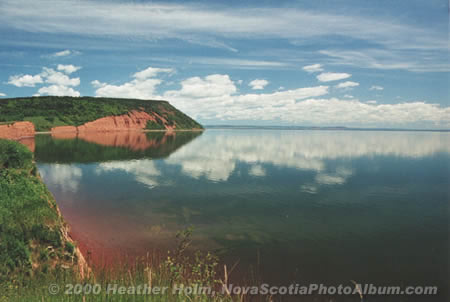
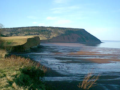
June 2000. (Heather Holm photo)
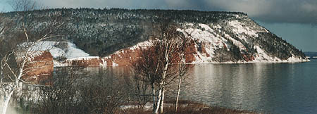
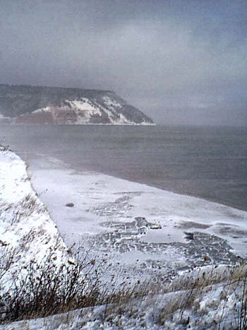
Winter 1999-2000. (H. Holm photo)
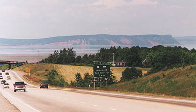
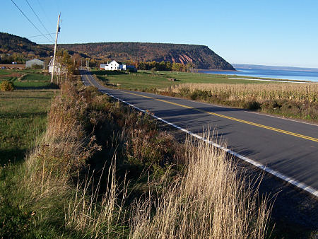
Coming home to the Annapolis Valley on Highway 101 outside Avonport. To Valley-dwellers, this view of Blomidon means “home”. (H. Holm photo)
The receding tide leaves a bright skim of water on the beach. Here are the world’s highest tides – up to 50 ft high. The tide comes and goes twice a day in a powerful rhythm. (H. Holm photo)
Low tide now, and the sand is drying out. (H. Holm photo)
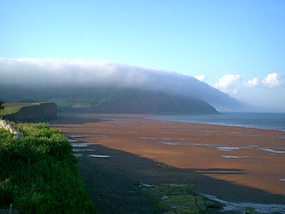
The fog is Glooscap’s Blanket, for Blomidon is a dwelling place of the Mi’kmaq god Glooscap. (H. Holm photo)
Fog rolls in over mystical Cape Blomidon. (E. Sepulchre photo)
Glooscap’s Blanket. (E. Sepulchre photo)
Blomidon with clematis. (E. Sepulchre photo)
This is what the cliff face looks like close up, from a small plane. For more, see “From the air”. (H. Holm photo)
A storm rages, Christmas 2000. (E. Sepulchre photo)
The road to Blomidon in the winter. (H. Holm photo)
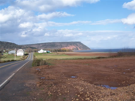
Looking back down the road. This rich farmland was first settled by Acadians in the 17th century. (H. Holm photo)
October 2007
The same road at the end of October, with the remnants of a huge pile of potatoes in the foreground. (D. Robinson photo)
Blomidon’s Moods
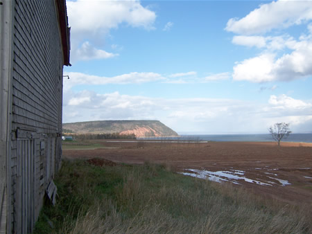
This view feels more private to me, peaking at Blomidon’s face from behind the barn, no public road between us. (D. Robinson photo)
Blomidon as seen from behind the Robie Tufts Centre in Wolfville in October, with the dyked hayfields originally reclaimed from the tides by Acadian settlers 300 years ago. (D. Robinson photo)
Late afternoon sun turns the marsh grass gold and the Wolfville mud purple. (The town’s original name was Mud Creek.) Blomidon sits serenely in the distance, while a bank of cloud from the Bay of Fundy rolls over. (D. Robinson photo)
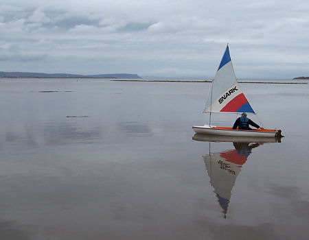
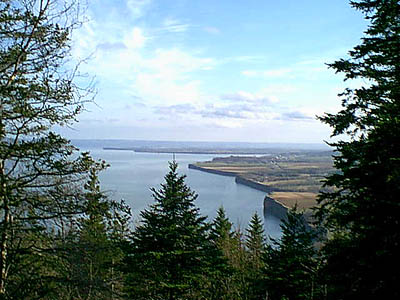
A sailboat drifts languidly in the world’s smallest registered harbour, Wolfville, now swollen with the highest tide of the year.
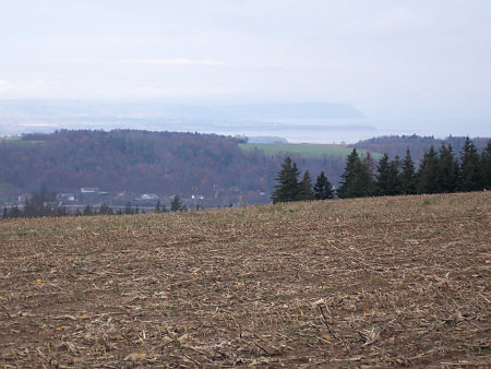
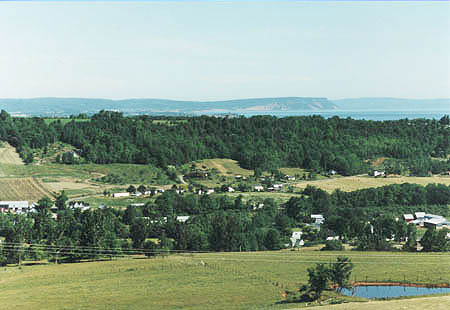
From a cornfield on the South Mountain, high over the Gaspereau Valley, Blomidon floats like a ghost, like a shadow of itself, in the distance. (D. Robinson photo)
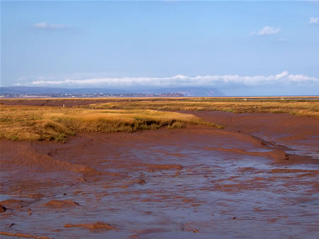
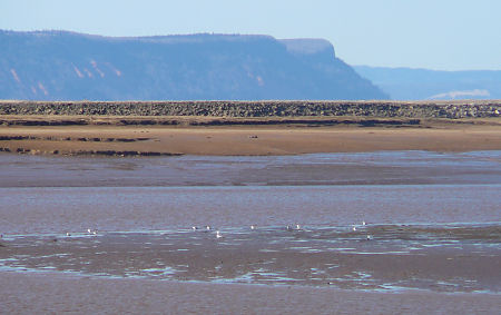
Millions of migrating birds feed on mud-dwelling creatures on the tidal mud flats. Even in April, birds dot the intertidal zone. (H. Ortscheid photo)
The ice on the beach contains the red sand of the Minas Basin. (H. Holm photo)
View from high up on Cape Blomidon looking south toward Wolfville. Tide is high and the water goes right up to the cliff. (H. Holm photo)
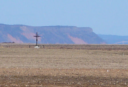
The iron cross marks the spot in Horton’s Landing where, in 1755, the new British masters of Nova Scotia put 10,000 French-speaking Acadians on boats and sent them away from the land they had farmed for generations. (H. Ortscheid photo)
There’s a lovely lacey waterful along one of the trails going up to Blomidon Provincial Park. (H. Holm photo)
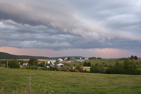
On the road to Blomidon. A storm is coming. Late summer 2004. (H. Holm photo)
Incoming tide, June 2009.
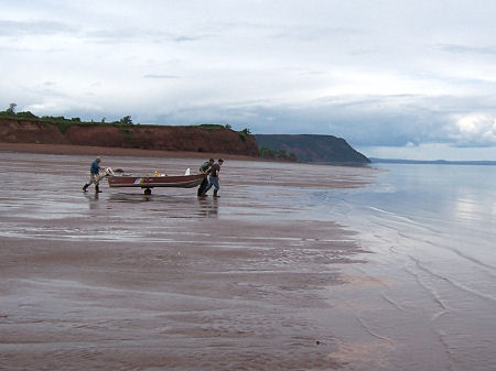
Wheeling a boat over the sand towards the incoming tide, off to fish for flounder. June 2009.
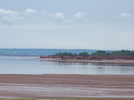
Looking in the other direction, towards Medford. There’s a fishing boat in the middle distance. June 2009.
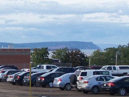
Blomidon from a busy parking lot at Acadia University in Wolfville
The Gaspereau Valley from Norwegian Bend, the hairpin turn going up the South Mountain, with Blomidon in the distance. Wolfville lies on the other side of the ridge in the middle distance.